
“The airspace begins directly above ground level”
We believe we have a world first: for the first time, designers have focused on the spatial organization of airspace. Three design teams delved into the rapidly evolving world of drones during the Urban Sky Lab. How can designers contribute to the livable, smart city of the future?
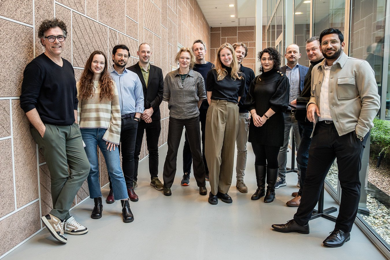
The Urban Sky Lab team. Vlnr: Eric Frijters (FABRICations), Viktoriia Tverdokhlib (Inbo), Mohammed Reza Alkaabi (Studio To Create), Geert-Jan Staal (Politie Amsterdam), Indira van 't Klooster (Arcam), Vries Strookman (Amsterdam Drone Lab), Daphne Bouman (Arcam), Mark Kanters (Inbo), Reyhan Safari (RAI), Pim Stevens (ADL), Tom van Arman (Tapp), Murtada Alkaabi (Studio To Create). Photograpy: Maarten Nauw
Urban Sky Lab
At this moment, the use of drones is still limited by regulations, but once safety can be ensured, development will progress rapidly. What does a city full of drone traffic look like? How do drones move? How much noise do they produce? Where do they land? Where do they recharge? What about privacy? How much space does a drone actually need? The design lab started with many questions.
Rapidly developing technologies have previously led to undesirable situations in the city, such as the rise of dark stores and flash delivery services. To prevent this around drones, the Amsterdam Drone Lab wants to involve designers in the design of airspace at an early stage. The Urban Sky Lab is a two-day design sprint organized by the Amsterdam Drone Lab and Arcam.
Empowered with technical knowledge about drones from Droneland, Vertiports by AirHub, insights into the smart city by Tom van Arman, and airspace regulations by the Ministry of Infrastructure and Water Management, the three teams focused on three different case locations. FABRICations explored the Western Port Area (the macro-scale of a 'drone highway system'), Studio To Create delved into the Amsterdam Southeast location (regional hubs and opportunities for socio-economic stimulus), and Inbo focused on the RAI (the building as a land-load-arrival-departure point for people and drones).
Approach
Questions the teams focused on were related to flying without air traffic control. How does this coexist with manned aviation? Drones can fly from A to B automatically with preprogrammed routes or can react to their surroundings during their route. There also need to be places in the city for maintenance and services.
There is also a shortage of space in the airspace, and much is still unclear about the application of drones. Much depends on the technical development of drones in the coming years. The focus is still on legislation, public acceptance/embracement, and safety. Thinking about the layout of airspace is still in its infancy. The insights from the design teams after two days of thinking about this topic were already immensely valuable; and that calls for more design research on this theme in the future.

Photograpy: Maarten Nauw
The results can be seen at the Arcam gallery from March 28th. Around the Amsterdam Drone Week, we will organize at least one (international) gathering at Arcam about the role of designers in drone-related issues. Keep an eye on the website for more information.
This article was previously published op www.arcam.nl.